Technology / Cartography from Chris Hartmann, Bookseller
Novidades

Phantom Islands of the Atlantic: The Legends of Seven Lands That Never Were
por Johnson, Donald S
- Condição
- Usado - Fine in Fine DJ
- Edição
- 2nd Printing
- Published
- 1994
- Encadernação
- Hardcover
- ISBN
- 9780802713209
- Quantidade Disponível
- 1
- Livreiro
-
Morganton, North Carolina, USA
- Preço do item
-
€ 16,69
Mostrar detalhes
Descrição:
New York: Walker & Co.. Hardcover. 1994. 2nd Printing. 8vo 220pp . Fine in Fine DJ. B&W Illustrations Tales of seven nonexistent lands conjured out of myth or human error but nonetheless appearing on maps for centuries . Preço do item
€ 16,69
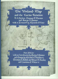
The Vinland Map and the Tartar Relation
por Skelton, R. A, Marston, Thomas E, and Painter, George D
- Condição
- Usado - Fine in Fine DJ
- Edição
- New Edition
- Published
- 1995
- Encadernação
- Hardcover
- ISBN
- 9780300065206
- Quantidade Disponível
- 1
- Livreiro
-
Morganton, North Carolina, USA
- Preço do item
-
€ 33,37
Mostrar detalhes
Descrição:
New Haven: Yale Univ. Press. Hardcover. 1995. New Edition. 4to 291pp . Fine in Fine DJ. B&W Illustrations. Now, on the 30th anniversary of its original publication, here is this classic of historical cartography in a new edition. It reprints unaltered the original text on the Vinland Map and an account of Friar John of Plano Carpini's mission to the… Ler mais sobre este item Preço do item
€ 33,37

The Mapmakers
por Wilford, John Noble
- Condição
- Usado - Fine in Fine DJ
- Edição
- 1st Edition
- Published
- 1981
- Encadernação
- Hardcover
- ISBN
- 9780394461946
- Quantidade Disponível
- 1
- Livreiro
-
Morganton, North Carolina, USA
- Preço do item
-
€ 22,25
Mostrar detalhes
Descrição:
New York: Alfred A. Knopf. Hardcover. 1981. 1st Edition. 8vo 414pp . Fine in Fine DJ. B&W Illustrations. The story of the great pioneers in cartography, from antiquity to the space age . Preço do item
€ 22,25
Roman Britain
por Great Britain. Ordnance Survey
- Condição
- Usado - Fine with no DJ
- Edição
- 4th Edition
- Published
- 1978
- Encadernação
- Hardcover
- Quantidade Disponível
- 1
- Livreiro
-
Morganton, North Carolina, USA
- Preço do item
-
€ 27,81
Mostrar detalhes
Descrição:
Southampton, England: Ordnance Survey. Hardcover. 1978. 4th Edition. 4to 31pp . Fine with no DJ. Maps Cover title: Map of Roman Britain Contains 2 large folded maps, a north sheet map and a south sheet map . Preço do item
€ 27,81
