Maps And Atlases from Andrew Langer, Bookseller
Novidades

The Admiralty Chart: British Naval Hydrography in the Nineteenth Century
por Ritchie, G. S.
- Condição
- Usado - Very Good+ in Very Good dust jacket
- Edição
- First Edition; Second Impression
- Published
- 1968
- Encadernação
- Hardcover
- ISBN
- 9780370004792
- Quantidade Disponível
- 1
- Livreiro
-
BERKELEY, California, USA
- Preço do item
-
€ 28,32
Mostrar detalhes
Descrição:
London - Sydney - Toronto: Hollis & Carter. Very Good+ in Very Good dust jacket. 1968. First Edition; Second Impression. Hardcover. 0 370 00479 5 . Gray cloth boards, gilt-stamped spine lettering, ilustrated with photographs (on inserted plates) and maps (two are double-page), Light green dust jacket. ; 5-3/4" x 8-3/4"; xi, 388 pp; Author was Rear… Ler mais sobre este item Preço do item
€ 28,32
Origin of the STRAIT OF ANIAN Concept
por Nunn, George E.
- Condição
- Usado - Very Good with no dust jacket
- Published
- 1929
- Encadernação
- Hardcover
- Quantidade Disponível
- 1
- Livreiro
-
BERKELEY, California, USA
- Preço do item
-
€ 70,79
Mostrar detalhes
Descrição:
Philadelphia: Privately Printed. Very Good with no dust jacket. 1929. Hardcover. Mottled brown paper over thin boards, brown cloth spine, pastedown title label to front cover, frontispiece reproduces earliest known map showing the Strair of Anian, 4 additional Figures within text. One from a numbererd Two Hundred Copies Printed. ; 6" x 9"; 36 pp; Wear… Ler mais sobre este item Preço do item
€ 70,79

A History of the Cartography of Russia Up to 1600 / A History of Russian Cartography Up to 1800 (Two Volumes)
por Bagrow, Leo; Henry W. Castner (Edited by)
- Condição
- Usado - Very Good with no dust jacket
- Published
- (1975)
- Encadernação
- Hardcover
- ISBN
- 9780969051404
- Quantidade Disponível
- 1
- Livreiro
-
BERKELEY, California, USA
- Preço do item
-
€ 117,99
Mostrar detalhes
Descrição:
Wolfe Island, Ontario: The Walker Press. Very Good with no dust jacket. (1975). Hardcover. 0-9690514-0-9 . Volumes are uniformly bound in green cloth with dark green lettering and map designs to front covers, texts are accompanied by many reproduction s of maps. ; 9" x 11-3/4"; xv, 140 + xiv, 312 pp; Lightly bumped at corners, later volume… Ler mais sobre este item Preço do item
€ 117,99

Mais fotos
Atlas Geographico del Reyno de España, e Islas Adyacentes con una breve descripcionde sus Provincias. Dispuesto para la utilidad publica
por Lopez, Tomas
- Condição
- Usado - Very Good+ with no dust jacket
- Published
- 1991
- Encadernação
- Hardcover
- Quantidade Disponível
- 1
- Livreiro
-
BERKELEY, California, USA
- Preço do item
-
€ 89,67
Mostrar detalhes
Descrição:
Madrid: Galeria Frame. Very Good+ with no dust jacket. 1991. Hardcover. Maps of Spain and terrirtories, captioned in Spanish. Reproduction in miniature of an atlas first produced in 1757; one from an edition of 200 copies. Brown cloth boards, leather spine embellished with tooling and gold spine bands, colored maps are reproduced full page, printed recto… Ler mais sobre este item Preço do item
€ 89,67

JUNIOR ATLAS OF ALBERTA: our place on earth and how we live
por Alberta Education and the University of Alberta, Department of Geography
- Condição
- Usado - Very Good+ with no dust jacket
- Published
- 1979
- Encadernação
- Hardcover
- Quantidade Disponível
- 1
- Livreiro
-
BERKELEY, California, USA
- Preço do item
-
€ 42,48
Mostrar detalhes
Descrição:
Edmonton, Alberta: Alberta Education. Very Good+ with no dust jacket. 1979. Hardcover. 920704-40-8 . Geography textbook prepared under the auspices of the Alberta Heritage Learning Resources Project. Color cover, endpapers with view from space, maps and pictures within illustrated in cover, Glossary, Index and References at rear. Errata sheet laid in. Uncommon in the trade. … Ler mais sobre este item Preço do item
€ 42,48
A la Carte: Selected Papers on Maps and Atlases
por Ristow, Walter W. et al
- Condição
- Usado - Very Good with no dust jacket
- Published
- 1975
- Encadernação
- Hardcover
- ISBN
- 9780844400044
- Quantidade Disponível
- 1
- Livreiro
-
BERKELEY, California, USA
- Preço do item
-
€ 18,88
Mostrar detalhes
Descrição:
Washington: Library of Congress. Very Good with no dust jacket. 1975. Hardcover. 0-8444-0004-1 . White cloth with designs to covers and lettering, in brown. Decorative map endpapers. Edited by Wristow; presents illustrated papers by various authors about LoC holdings. Most of the papers originally appeared in the Library of Congress Quarterly Journal.; 8" x 10-1/2"; x,… Ler mais sobre este item Preço do item
€ 18,88
Mitchell's New School Atlas. Mitchell's MODERN ATLAS:
por Mitchell, S. Augustus
- Condição
- Usado - Good+ with no dust jacket
- Published
- 1871
- Encadernação
- Hardcover
- Quantidade Disponível
- 1
- Livreiro
-
BERKELEY, California, USA
- Preço do item
-
€ 70,79
Mostrar detalhes
Descrição:
Philadelphia: E. H. Butler & Co.. Good+ with no dust jacket. 1871. Hardcover. a series of Forty-Four Copperplate Maps, compiled from the great atlases of Keith Johnston, Kiepert, The Geographical Institute of Weimar, from the United States Coast Survey, the surveys of the War Department and of the several states, and from other reliable authorities, drawn… Ler mais sobre este item Preço do item
€ 70,79
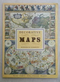
Decorative Maps
por Barron, Roderick
- Condição
- Usado - Very Good+ with no dust jacket
- Edição
- No printing noted
- Published
- (1989)
- Encadernação
- Softcover
- ISBN
- 9781851702985
- Quantidade Disponível
- 1
- Livreiro
-
BERKELEY, California, USA
- Preço do item
-
€ 23,60
Mostrar detalhes
Descrição:
London: Bracken Books. Very Good+ with no dust jacket. (1989). No printing noted. Softcover. 1-85170-298-9 . With Forty Full Colour Plates. Stiff illustrated wraps, perfect bound, 8 pp text plus forty full-page plates - illustration on recto with captions verso. A volume in the Poster Art series. This copy signed by author Roderick Barron on the title… Ler mais sobre este item Preço do item
€ 23,60
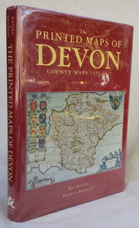
The Printed Maps of DEVON: County Maps 1575-1837
por Batten, Kip and Francis Bennett
- Condição
- Usado - Very Good+ in Very Good+ dust jacket
- Edição
- First Edition; No printing noted
- Published
- (1996)
- Encadernação
- Hardcover
- ISBN
- 9780861149001
- Quantidade Disponível
- 1
- Livreiro
-
BERKELEY, California, USA
- Preço do item
-
€ 33,04
Mostrar detalhes
Descrição:
Devon: Devon Books. Very Good+ in Very Good+ dust jacket. (1996). First Edition; No printing noted. Hardcover. 0 86114 900 9 . Red cloth with gilt spine lettering, each map presented over two pages (some color). Red dust jacket with color image of map to front panel. Heavy, international shipping may be extra. ; 8-1/2" x 12"; … Ler mais sobre este item Preço do item
€ 33,04
